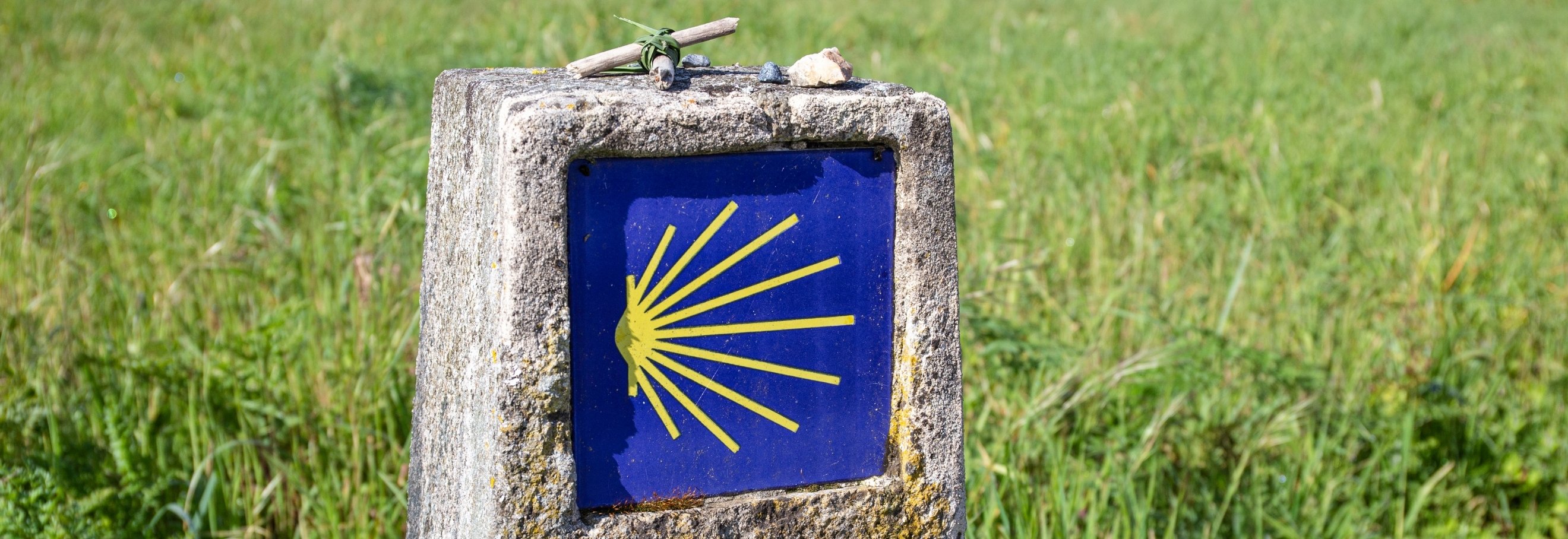
Central Portuguese Way: map, stages and complete guide
Way of Saint James
What to Do
The most travelled of the Portuguese Ways of St. James and one of the country's most historically significant pilgrimage routes, the Central Portuguese Way follows a centuries-old path north towards Santiago de Compostela. Along the way, pilgrims encounter ancient roads, medieval bridges, churches, monasteries, historic towns and rural landscapes.
The Central Portuguese Way crosses Portugal from south to north, passing through cities such as Lisbon, Coimbra and Porto. This guide focuses on the section officially certified as the Central Portuguese Way of St. James – Porto and Northern Portugal, which begins in the municipality of Oliveira de Azeméis and ends in Valença, near the border with Galicia.
Stretching approximately 178 kilometres (111 miles) across 13 municipalities and 12 recommended stages, the route crosses the Douro, Ave, Cávado, Lima and Minho rivers. Along the way, pilgrims discover remarkably diverse landscapes, from urban centres and ancient Roman roads to rural paths, traditional Minho estates and manor houses, mountains and valleys.
Explore the map, discover the stages and learn about the heritage sites, pilgrim hostels and practical information you need to plan your journey along the Central Portuguese Way in Porto and Northern Portugal.
You can also explore all the Ways of St. James in Porto and Northern Portugal.
Central Portuguese Way: key information
Official name: Central Portuguese Way of St. James - Porto and Northern Portugal
Starting point of the Porto and Northern Portugal section: Oliveira de Azeméis
End of the route in Portugal: Valença
Continuation: Tui and Santiago de Compostela
Certified route length: 177.8 km (110.5 miles)
Number of stages on the official map: 12
Municipalities crossed: 13
Usual direction: South to north
Difficulty: Easy to moderate, depending on the stage
Certification: Ordinance No. 445/2023
The certified route passes through Oliveira de Azeméis, São João da Madeira, Santa Maria da Feira, Vila Nova de Gaia, Porto, Matosinhos, Maia, Vila do Conde, Póvoa de Varzim, Barcelos, Ponte de Lima, Paredes de Coura and Valença.
What is the history of the Central Portuguese Way?
Long before the waymarking signs that guide pilgrims today, these ancient routes already connected the southern and northern parts of the Iberian Peninsula.
Research carried out as part of the route's certification process uncovered evidence of its regular use between the Douro and Minho regions, including accounts from pilgrims of different nationalities dating from the 14th to the 18th centuries.
Much of the route follows the ancient Estrada Real (Royal Road), which itself traced important Roman roads along the north–south axis. Among these was Route XVI of the Antonine Itinerary, which connected Lisbon and Braga.
The construction of bridges during the Middle Ages also helped establish the most direct route between Porto and Valença. Along the Way, pilgrims can still discover churches dedicated to St. James, former hospitals and pilgrim hostels, wayside crosses, bridges and other historic reminders of the centuries of pilgrimage.
The significance of this heritage led to three sections of the route being officially recognised as having high heritage value:
- In Porto, between the northern end of the Dom Luís I Bridge and Praça de Carlos Alberto;
- In Barcelos, between Largo do Tanque, in Barcelinhos, and Largo do Bem Feito;
- In Ponte de Lima, between the Chapel of Nossa Senhora da Guia and Largo da Alegria, in Arcozelo.
Did you know?
The Central Portuguese Way is also linked to some of the region’s best-known legends. The ordinance officially certifying the route specifically highlights the legends of the Rooster of Barcelos, Saint Elizabeth of Portugal and the knight Cayo Carpo as part of the intangible cultural heritage associated with the Way.
What are the stages of the Central Portuguese Way?
The stages provide a useful framework for planning the route. They can be adapted to each pilgrim's fitness level, available accommodation and the time they wish to spend exploring the towns and heritage sites along the Way.
|
Stage
|
Route
|
Distance on the map
|
Difficulty
|
|---|---|---|---|
|
1
|
Oliveira de Azeméis – São João da Madeira
|
18.34 km (11.4 miles)
|
Easy to moderate
|
|
2
|
São João da Madeira – Santa Maria da Feira
|
11.43 km (7.1 miles)
|
Easy
|
|
3
|
Santa Maria da Feira – Vila Nova de Gaia
|
13.05 km (8.1 miles)
|
Easy
|
|
4
|
Vila Nova de Gaia – Porto
|
10.32 km (6.4 miles)
|
Easy
|
|
5
|
Porto – Matosinhos
|
6.59 km (4.1 miles)
|
Easy to moderate
|
|
6
|
Matosinhos – Maia
|
6.30 km (3.9 miles)
|
Easy to moderate
|
|
7
|
Maia – Vila do Conde
|
12.42 km (7.7 miles)
|
Easy to moderate
|
|
8
|
Vila do Conde – Póvoa de Varzim
|
13.47 km (8.4 miles)
|
Easy to moderate
|
|
9
|
Póvoa de Varzim – Barcelos
|
16.36 km (10.2 miles)
|
Easy to moderate
|
|
10
|
Barcelos – Ponte de Lima
|
33.75 km (21.0 miles)
|
Moderate
|
|
11
|
Ponte de Lima – Paredes de Coura
|
17.52 km (10.9 miles)
|
Easy to moderate
|
|
12
|
Paredes de Coura – Valença
|
17.98 km (11.2 miles)
|
Easy to moderate
|
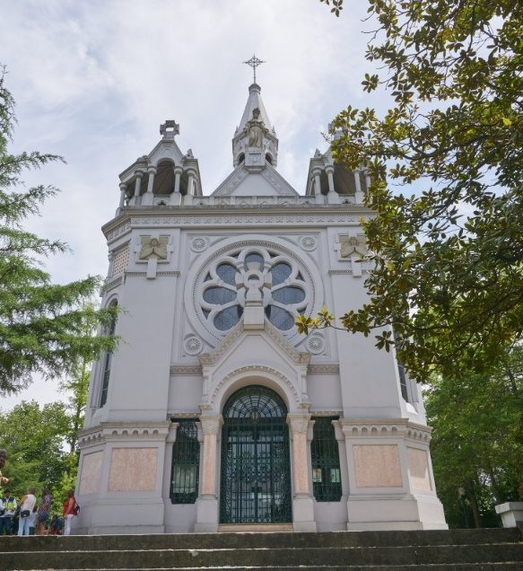
Oliveira de Azeméis: where the Way enters Porto and Northern Portugal
Reference stage: Oliveira de Azeméis - São João da Madeira
Distance: 18.34 km (11.4 miles)
Difficulty: Easy to moderate
Oliveira de Azeméis is where the certified Porto and Northern Portugal section continues the Way from Portugal's Central Region.
The route enters the municipality through Pinheiro da Bemposta, passes through Bemposta and approaches the centre of Oliveira de Azeméis. It then heads north through Santiago de Riba-Ul and Cucujães before continuing towards São João da Madeira.
The landscape alternates between urban areas, cobbled paths, farmland and woodland. One of the most important sites associated with the pilgrimage to Santiago is the Church of Santiago de Riba-Ul, which houses a limestone sculpture of St. James attributed to a workshop in Coimbra dating from the late 15th century.
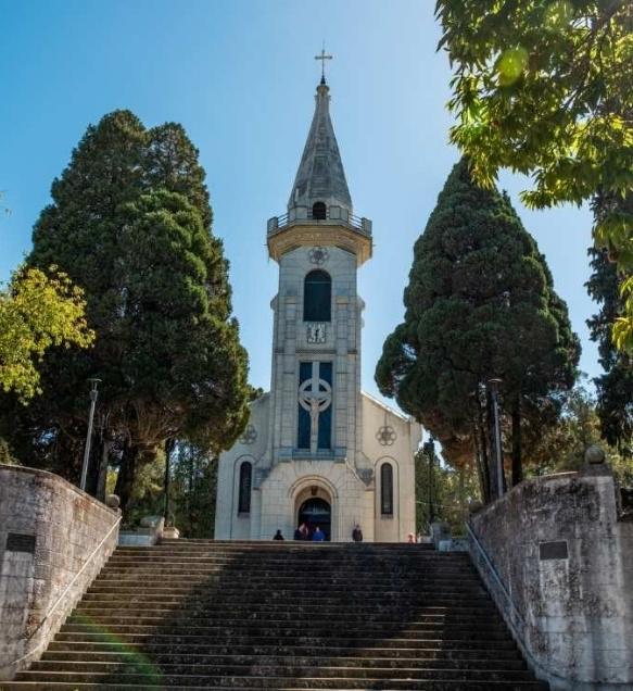
São João da Madeira: industry, urban life and the tradition of the Way of St. James
Reference stage: São João da Madeira – Santa Maria da Feira
Distance: 11.43 km (7.1 miles)
Difficulty: Easy
After Cucujães, the Way passes through São João da Madeira, following a predominantly urban route.
This section is quite different from the rural paths that pilgrims will encounter further north, reflecting the city's industrial past and present. There is even a local tradition linking St. James to the discovery of the felting process later used in hatmaking, one of São João da Madeira's most iconic industries.
The route then continues towards Arrifana, in the municipality of Santa Maria da Feira.
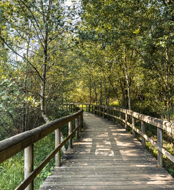
Santa Maria da Feira: through the historic Lands of Santa Maria
Reference stage: Santa Maria da Feira – Vila Nova de Gaia
Distance: 13.05 km (8.1 miles)
Difficulty: Easy
Arrifana marks the entrance to the municipality of Santa Maria da Feira along the Way. From here, the route crosses an area closely linked to the ancient Estrada Real (Royal Road), where references to St. James are particularly prominent.
Within the municipality, the route passes through the parishes of Arrifana, Escapães, São João de Ver, Fiães, Lourosa, Mozelos and Nogueira da Regedoura. The municipality has installed dedicated waymarking signs to guide pilgrims along this section.
As the route approaches the boundary with Vila Nova de Gaia, it passes close to Grijó.
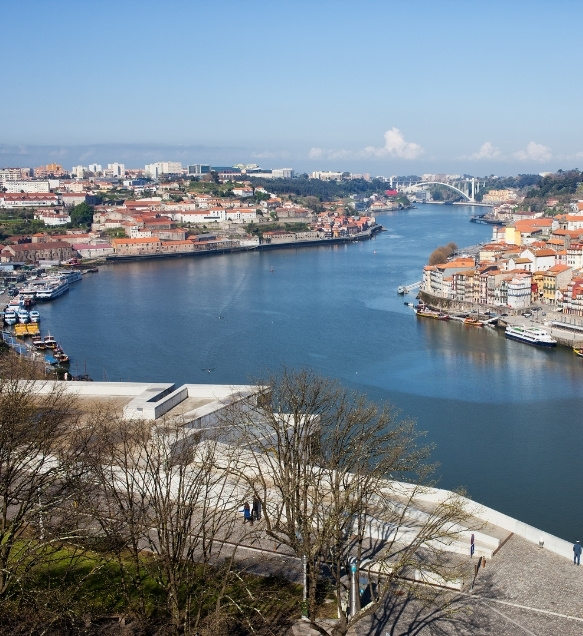
Vila Nova de Gaia: from monasteries to the Douro River
Reference stage: Vila Nova de Gaia – Porto
Distance: 10.32 km (6.4 miles)
Difficulty: Easy
The Way enters Vila Nova de Gaia through Grijó and continues north. Key points along this section include Perosinho, Serra de Negrelos and, as the route approaches the Douro River, the urban centre of Vila Nova de Gaia.
The Monastery of São Salvador de Grijó is one of the most important landmarks along this stretch. Further north, the route approaches the Corpus Christi Convent, which houses a depiction of St. James associated with the convent founder's devotion to the saint.
Crossing the Douro River via the Dom Luís I Bridge finally brings pilgrims into Porto, where the route climbs towards Porto Cathedral.
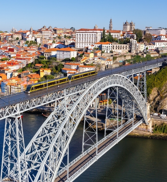
Porto: through one of the most historically significant sections of the Way
Reference stage: Porto – Matosinhos
Distance: 6.59 km (4.1 miles)
Difficulty: Easy to moderate
After crossing the Dom Luís I Bridge, pilgrims climb towards Porto Cathedral. The city is one of the major landmarks along the Central Portuguese Way, with numerous historical connections to the pilgrimage to Santiago de Compostela.
The section between the northern end of the Dom Luís I Bridge and Praça de Carlos Alberto has been officially recognised as having high heritage value.
From the Cathedral, the Way passes through the historic centre and continues towards Cedofeita, Carvalhido and the boundary with Matosinhos.
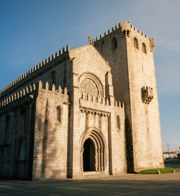
Matosinhos: where the Central Portuguese Way and the Portuguese Coastal Way diverge
Reference stage: Matosinhos – Maia
Distance: 6.30 km (3.9 miles)
Difficulty: Easy to moderate
Padrão da Légua marks one of the key junctions along the route. This is where the two Ways diverge: the Portuguese Coastal Way heads in a different direction, while the Central Portuguese Way continues north towards Custóias and Leça do Balio.
The Monastery of Leça do Balio played a particularly important role in the history of pilgrimage. Associated with the Order of the Hospitallers, it welcomed both ordinary travellers and members of royalty making their way to Santiago de Compostela.
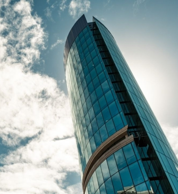
Maia: farmland and ancient routes north
Reference stage: Maia – Vila do Conde
Distance: 12.42 km (7.7 miles)
Difficulty: Easy to moderate
The Way crosses the municipality of Maia through areas where the urban landscape gradually gives way to farmland.
Moreira is one of the main landmarks along this section, with the Monastery of Divino Salvador de Moreira located close to the route. The Way then continues through Vilar do Pinheiro and Mosteiró, heading towards Vairão and Macieira da Maia, already in the municipality of Vila do Conde.
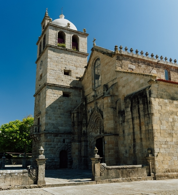
Vila do Conde: Vairão, bridges and monasteries on the way to Rates
Reference stage: Vila do Conde – Póvoa de Varzim
Distance: 13.47 km (8.4 miles)
Difficulty: Easy to moderate
The Central Portuguese Way crosses a very different part of the municipality from the route followed by the Portuguese Coastal Way.
After entering the municipality, the Way passes through Vairão and Macieira da Maia. It then continues through a predominantly rural landscape, passing the Dom Zameiro Bridge, the Monastery of São Simão da Junqueira and the area around São Miguel dos Arcos.
The next destination is São Pedro de Rates, already in the municipality of Póvoa de Varzim.
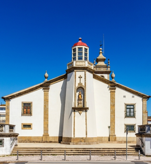
Póvoa de Varzim: São Pedro de Rates, one of the major landmarks along the Way
Reference stage: Póvoa de Varzim – Barcelos
Distance: 16.36 km (10.2 miles)
Difficulty: Easy to moderate
In the municipality of Póvoa de Varzim, the Central Portuguese Way mainly crosses inland areas, particularly São Pedro de Rates, offering a very different landscape from the Portuguese Coastal Way.
The Romanesque Church of São Pedro de Rates is one of the most important historical landmarks along the entire route and is specifically mentioned in the official certification documentation.
From here, the Way continues through Pedra Furada, heading towards Barcelinhos and Barcelos.
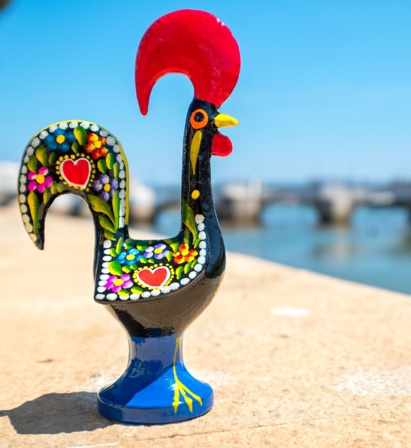
Barcelos: the Rooster legend and a rich tradition of pilgrimage to Santiago
Reference stage: Barcelos – Ponte de Lima
Distance: 33.75 km (21.0 miles)
Difficulty: Moderate
Pilgrims enter Barcelos through Barcelinhos. The Chapel of Nossa Senhora da Ponte and the crossing of the Cávado River mark the entrance to one of the Portuguese towns most closely associated with the history of pilgrimage to Santiago de Compostela.
The historic section between Largo do Tanque, in Barcelinhos, and Largo do Bem Feito, in Barcelos, has been officially recognised as having high heritage value.
After passing through the town centre, the Way continues through Vila Boa and Tamel, heading towards Ponte das Tábuas before crossing rural landscapes to Balugães and onwards into the municipality of Ponte de Lima.
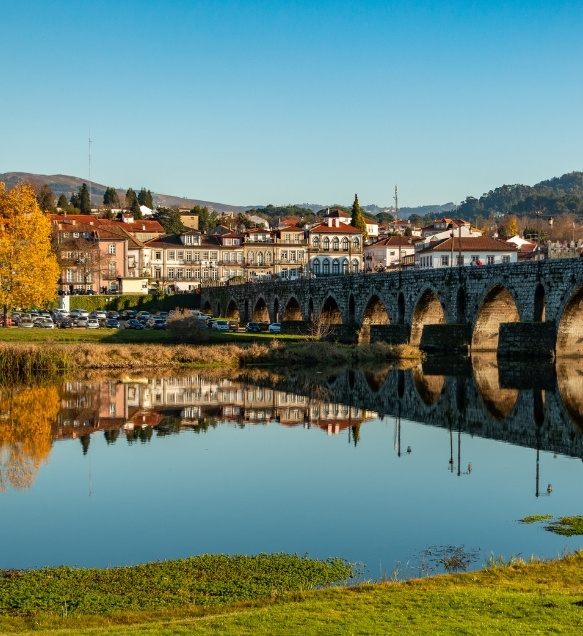
Ponte de Lima: from the valley to the challenging Serra da Labruja
Reference stage: Ponte de Lima – Paredes de Coura
Distance: 17.52 km (10.9 miles)
Difficulty: Easy to moderate
The Way crosses a considerable part of the municipality of Ponte de Lima, both before and after reaching the town centre.
Coming from Barcelos, the route enters the municipality through Poiares. It then continues through Vitorino dos Piães, Facha, Seara and Correlhã before reaching Ponte de Lima.
After crossing the historic Roman-medieval bridge, the Way passes through Arcozelo and continues towards Calheiros, Cepões and Labruja.
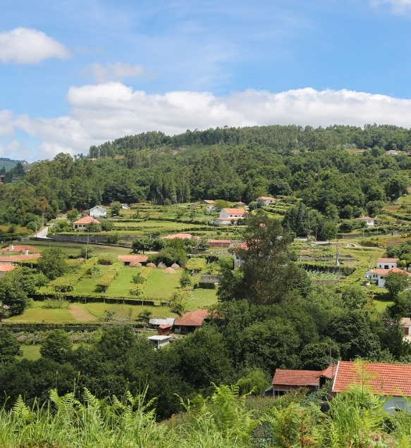
This is where pilgrims face one of the greatest physical challenges of the entire Central Portuguese Way: the ascent through Serra da Labruja to Portela Grande.
Paredes de Coura: Roman roads and the landscapes of Labruja
Reference stage: Paredes de Coura – Valença
Distance: 17.98 km (11.2 miles)
Difficulty: Easy to moderate
After crossing Portela Grande da Labruja, pilgrims enter the municipality of Paredes de Coura and descend towards Cabanas.
The route continues through Agualonga, where it crosses an ancient bridge, before approaching the Chapel of São Roque. It then follows another stretch of Roman-era paved road and passes through woodland towards Rubiães.
Here, pilgrims encounter one of the most important groups of historic landmarks along the Way: the Romanesque Church of São Pedro de Rubiães, classified as a National Monument, a Roman milestone dedicated to Emperor Caracalla and the Romanesque-Medieval Bridge.
After Rubiães, the Way continues through Couto das Cabras, Pecene and São Bento da Porta Aberta before heading towards Valença.
The municipality confirms that the Way currently crosses the parishes of Agualonga and Rubiães, as well as the Union of the Parishes of Cossourado and Linhares.
Valença: the final stage in Portugal
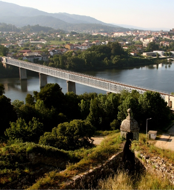
Valença marks the end of the Portuguese section of the Way and, at the same time, the gateway to Galicia.
The route approaches Valença through rural landscapes, following ancient paths and remnants of the Roman road network.
Coming from Rubiães, the Way passes through São Bento da Porta Aberta, Gontomil, Fontoura, Paços, Pedreira, Tuído and Arão before reaching Valença.
The impressive fortress dominates the approach to the town. After passing through the fortified historic centre, pilgrims head towards the International Bridge over the River Minho. Halfway across the bridge, they leave Portugal behind and enter Tui, in Galicia.
Valença is also where the Central Portuguese Way meets the Portuguese Coastal Way.
Where to stay along the Central Portuguese Way?
In addition to dedicated pilgrim hostels and youth hostels, the municipalities along the Way offer hotels, guesthouses, rural accommodation and other places to stay overnight.
Opening hours, availability and access conditions at pilgrim hostels may change. We recommend contacting accommodation providers in advance before setting off.
Explore accommodation options to suit different travel preferences:
How to prepare for the Central Portuguese Way?
Adapt the stages to your fitness level
The Central Portuguese Way has 12 recommended stages, but you do not have to follow them exactly. The Barcelos–Ponte de Lima stage, for example, covers 33.75 km (21 miles) and may be too long for those who are not used to walking for several consecutive days.
You can split this stage into two and arrange accommodation along the way.
Train before setting off
Gradually increase the length of your walks and, in the final weeks before departure, practise walking with the backpack you intend to carry.
On the Central Portuguese Way, it is particularly important to prepare for Serra da Labruja, the most physically demanding section of the route.
Choose suitable footwear
The Way combines asphalt, cobbled streets, minor roads, rural paths, dirt tracks and sections of ancient roads. Choose comfortable footwear that you have already worn and tested.
Confirm your accommodation
Contact pilgrim hostels in advance, particularly during busier periods. Opening hours, access conditions and capacity may vary.
Check the weather forecast
The route crosses a wide variety of landscapes. In summer, some sections offer little shade, while in winter, rain, mud and slippery surfaces can make the stages more challenging.
Useful information about the Central Portuguese Way
Did you know?
It is the most travelled Portuguese Way of St. James
Turismo de Portugal identifies the Central Portuguese Way as the most travelled of the Portuguese Ways of St. James.
Its official certification is relatively recent
Despite its centuries of history, the Central Portuguese Way – Porto and Northern Portugal section was officially certified in December 2023.
Three sections have received additional heritage recognition
Sections of the route in Porto, Barcelos and Ponte de Lima have been officially recognised as having high heritage value.
The Rooster of Barcelos also tells a pilgrim's tale
The famous legend is linked to a pilgrim who was falsely accused while travelling to Santiago de Compostela. This aspect of the region's intangible cultural heritage is explicitly acknowledged in the official certification of the Way.
The route crosses five major rivers
In Porto and Northern Portugal, the Central Portuguese Way crosses the Douro, Ave, Cávado, Lima and Minho rivers.
Frequently asked questions about the Central Portuguese Way
Follow one of the great Ways of St. James in Porto and Northern Portugal
The Central Portuguese Way brings together centuries of pilgrimage history on a journey through cities, villages, ancient roads, bridges, monasteries, mountains and valleys.
From the first steps through Oliveira de Azeméis to the crossing of the River Minho in Valença, each stage reveals a new landscape and another chapter in the history of the Way.
Choose your stages, pack your backpack and follow the yellow arrows towards Santiago de Compostela.
Buen Camino!
Discover all the Ways of St. James in Porto and Northern Portugal.