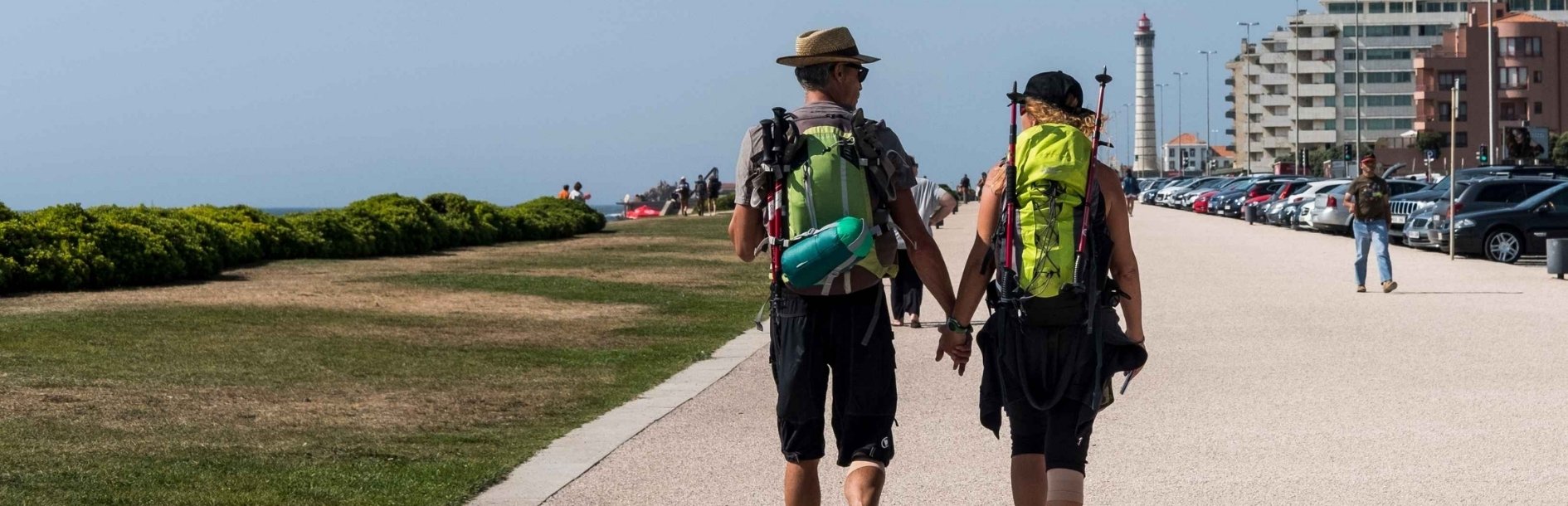
Portuguese Coastal Way: map, stages and complete guide
Way of Saint James
What to Do
From historic cities and Atlantic beaches to rural paths, rivers and ancient fortresses, the Portuguese Coastal Way offers one of the most rewarding journeys through Porto and Northern Portugal.
The route begins in Porto and heads north, crossing ten municipalities before reaching Valença, near the Spanish border. Along the way, urban landscapes give way to farmland, pine forests, dunes, wooden boardwalks, fishing villages and places shaped by the centuries-old tradition of pilgrimage to Santiago de Compostela.
Although known for its proximity to the ocean, the Portuguese Coastal Way does not always follow the coastline. Its historic route also passes through inland areas, particularly in the municipalities of Porto, Matosinhos and Maia, before approaching the coast and, further north, the banks of the Minho River.
Pack your backpack, explore the map, plan your stages and discover the rich heritage that accompanies pilgrims on their journey from Porto to Valença.
You can also explore the other Ways of St. James that cross Porto and Northern Portugal.
Portuguese Coastal Way: key information
Starting point: Porto
End of the route in Portugal: Valença
Continuation: Tui and Santiago de Compostela
Distance: Approximately 140–150 km
Average duration: Around 7 days
Difficulty: Easy to moderate
Usual direction: South to north
Municipalities crossed: 10
Type of route: Urban, rural, coastal and riverside
The intermunicipal website indicates a distance of 149.5 kilometres, an average duration of seven days and an easy-to-moderate difficulty level. However, the route's official certification specifies a distance of 138 kilometres.
When planning your journey, it is advisable to allow for approximately 150 kilometres, as the actual distance covered will depend on the route variations you follow, your choice of accommodation and any detours to explore places of interest.
What is the Portuguese Coastal Way?
The Portuguese Coastal Way is a pilgrimage route to Santiago de Compostela that connects Porto to the border between Portugal and Spain, before continuing towards Santiago de Compostela.
The route passes through the municipalities of Porto, Matosinhos, Maia, Vila do Conde, Póvoa de Varzim, Esposende, Viana do Castelo, Caminha, Vila Nova de Cerveira and Valença. From here, pilgrims cross the Minho River into Tui and join the Portuguese Way, which continues through Galicia.
Part of the route follows the ancient Via Veteris, mentioned in the Royal Inquiries of 1258 and an important link between Porto and Vila do Conde for centuries. The coastal route became increasingly popular among pilgrims during the early modern period, particularly from the 18th century onwards, as coastal towns and seaports developed.
Along the way, pilgrims can discover churches dedicated to St. James, former pilgrim hospices, monasteries, charitable institutions known as Misericórdias, bridges, stone wayside crosses and other reminders of the support provided to pilgrims throughout the centuries. The route's official certification also recognises the exceptional heritage value of the historic paths through Porto and Viana do Castelo.
Did you know?
More than 450 monuments can be discovered along the approximately 150 kilometres of this route. The Portuguese Coastal Way therefore offers the opportunity to combine a pilgrimage with a fascinating journey through Northern Portugal’s historical, religious and natural heritage.
Are the Portuguese Coastal Way and the Senda Litoral the same route?
The two names are often used interchangeably, but they do not refer to exactly the same route.
The officially certified Portuguese Coastal Way starts in Porto’s historic centre and passes through inland areas of Matosinhos and Maia before reaching the coast at Vila do Conde.
The Senda Litoral (Litoral Way), chosen by many pilgrims, leaves Porto Cathedral towards Ribeira, follows the Douro River to Foz and then continues along the Atlantic coast, passing through Matosinhos, Leça da Palmeira, Angeiras and Labruge.
The two routes eventually converge. The Litoral Way allows pilgrims to walk closer to the sea, but also means greater exposure to the sun and wind, with fewer shaded areas. The historic route, on the other hand, reveals ancient bridges, rural paths and places associated with the centuries-old tradition of providing assistance to pilgrims.
Portuguese Coastal Way distances by municipality
The Portuguese Coastal Way does not have to be completed according to a fixed daily schedule. The official website allows pilgrims to plan their stages and daily distances based on their fitness level, the places they wish to visit and the accommodation options available along the route.
To provide a clear and distinctive overview of the route, it can be divided into the ten municipalities it crosses. These sections do not necessarily correspond to ten days of walking: shorter stretches can be combined, while longer ones, such as those through Viana do Castelo and Caminha, can be split into multiple stages.
| Municipality | Distance | Estimated walking time |
|---|---|---|
| Porto | 5.6 km (3.5 miles) | 2h |
| Matosinhos | 6 km (3.7 miles) | 2h |
| Maia | 4.9 km (3.0 miles) | 1h 30m |
| Vila do Conde | 15.4 km (9.6 miles) | 4h |
| Póvoa de Varzim | 12.5 km (7.8 miles) | 3h |
| Esposende | 19.5 km (12.1 miles) | 4h 30m |
| Viana do Castelo | 28 km (17.4 miles) | 8h 40m |
| Caminha | 27 km (16.8 miles) | 6h |
| Vila Nova de Cerveira | 14.6 km (9.1 miles) | 4h |
| Valença | 16 km (9.9 miles) | 4h |
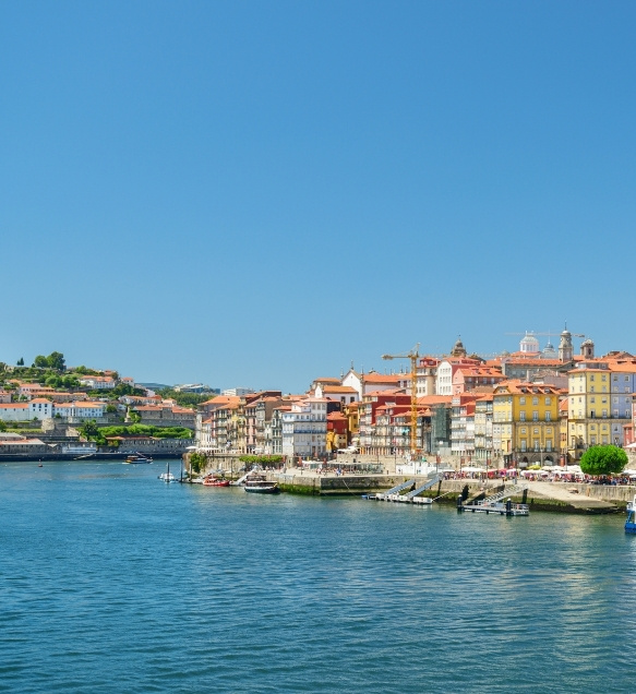
Porto: from Ribeira to the border with Matosinhos
Distance: 5.6 km (3.5 miles)
Estimated walking time: 2 hours
Type of route: Urban
Difficulty: Moderate
Although the historic Portuguese Coastal Way passes through the Ribeira district, many pilgrims choose to begin their journey at Porto Cathedral, where they can also obtain their Pilgrim's Credential. From there, the route heads north, crossing different parts of the city before continuing towards Matosinhos.
After leaving Porto Cathedral, the route follows the historic Olival area, passes through Cordoaria and approaches the churches of Carmo and Carmelitas. It then continues towards Cedofeita, Ramada Alta, Lapa, Carvalhido and Prelada, ending at the Estrada da Circunvalação, which marks the municipal boundary with Matosinhos.
This section is entirely urban, with some steeper uphill stretches in the first few kilometres.
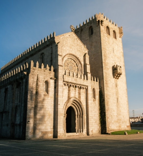
Matosinhos: from Padrão da Légua to D. Goimil Bridge
Distance: 6 km (3.7 miles)
Estimated walking time: 2 hours
Type of route: Urban
Difficulty: Easy
After crossing the Estrada da Circunvalação, pilgrims enter the municipality of Matosinhos and head towards the Padrão da Légua wayside cross. This is one of the most significant landmarks along the entire route, as it marks the point where the Portuguese Coastal Way diverges from the Central Portuguese Way.
The Coastal Way continues towards Custóias, passing through Largo do Souto and the Parish Church of Santiago. It then follows the historic territory of the Couto de Leça, which was associated for centuries with the Knights Hospitaller.
The route approaches the Monastery of Leça do Balio, crosses the Leça River via D. Goimil Bridge and ends near the boundary marker that once marked the limits of the historic Couto de Leça and the entrance to the lands of Maia.
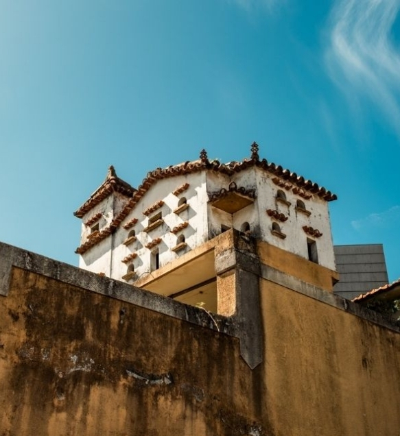
Maia: between Pedras Rubras and Vila Nova da Telha
Distance: 4.9 km (3.0 miles)
Estimated walking time: 1 hour 30 minutes
Type of route: Rural and urban
Difficulty: Easy
This short section through Maia continues from D. Goimil Bridge. It crosses urban and rural areas around Pedras Rubras, Moreira and Vila Nova da Telha, near Francisco Sá Carneiro Airport.
The route passes through an area significantly transformed by modern infrastructure, yet still home to chapels, churches, traditional houses and other elements of local heritage. After Vila Nova da Telha, it continues towards Aveleda, in the municipality of Vila do Conde.
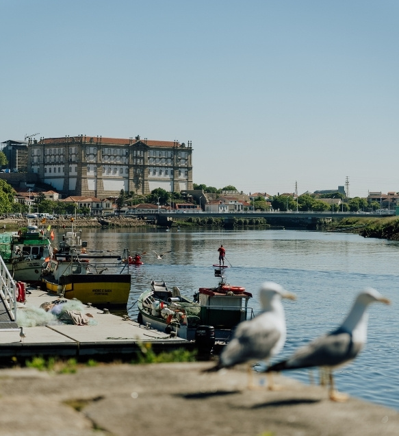
Vila do Conde: from Aveleda to the historic centre
Distance: 15.4 km (9.6 miles)
Estimated walking time: 4 hours
Type of route: Predominantly rural, with religious heritage sites
Difficulty: Easy
The Portuguese Coastal Way enters the municipality through Aveleda, passing through the villages of Lancaparte and Mota. It then continues towards the Church of Santiago de Labruge, through farmland and along rural paths.
From Labruge, the route passes through Javalana and Almas Grandes, near the boundary between Modivas and Vila Chã. It continues through wooded areas towards Mindelo, passing the parish church and the localities of Lameira and Paredes.
After Mindelo, the route approaches the Ornithological Reserve, continues through Pindelo, in Árvore, and Granja before reaching Azurara. Crossing the Ave River brings pilgrims into the historic centre of Vila do Conde, where the Way passes the Parish Church and the town's former administrative and religious quarter. Heading towards Póvoa de Varzim, the route continues through the areas of Alto da Pega and Poça da Barca.
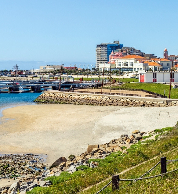
Póvoa de Varzim: from the city to the coastal farmlands
Distance: 12.5 km (7.8 miles)
Estimated walking time: 3 hours
Type of route: Rural, urban and coastal
Difficulty: Easy
The Portuguese Coastal Way enters Póvoa de Varzim from the southern side of the city, approaching the historic Praça Velha, Alto da Pega and Poça da Barca.
After crossing the urban centre, the route continues towards the coastline and fishing harbour. It then follows the extensive seafront, passing through the coastal parishes of Aver-o-Mar, Aguçadoura, Navais and Estela.
Wooden boardwalks, beaches, farmland and sand dunes accompany pilgrims until they reach Apúlia, in the municipality of Esposende.
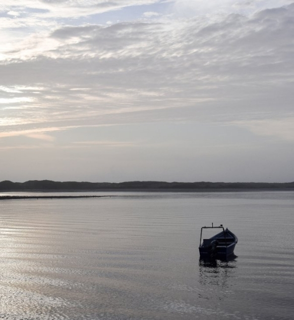
Esposende: from Apúlia to the Neiva River
Distance: 19.5 km (12.1 miles)
Estimated walking time: 4 hours 30 minutes
Type of route: Cultural and religious
Difficulty: Moderate
The Portuguese Coastal Way enters the municipality of Esposende through Apúlia and continues towards Fão, crossing an area characterised by beaches, sand dunes and the North Coast Natural Park.
After Fão, the route crosses the Cávado River and passes through the town of Esposende. It then continues through Marinhas, Mar, Belinho and Antas, ending at the crossing of the Neiva River, which marks the entrance to the municipality of Viana do Castelo.
There is also a historic route from São Pedro de Rates. This alternative passes through Lagoa Negra, in Barqueiros, and Fonte Boa before reaching Barca do Lago. After crossing the Cávado River, it joins the route towards Marinhas and Viana do Castelo.
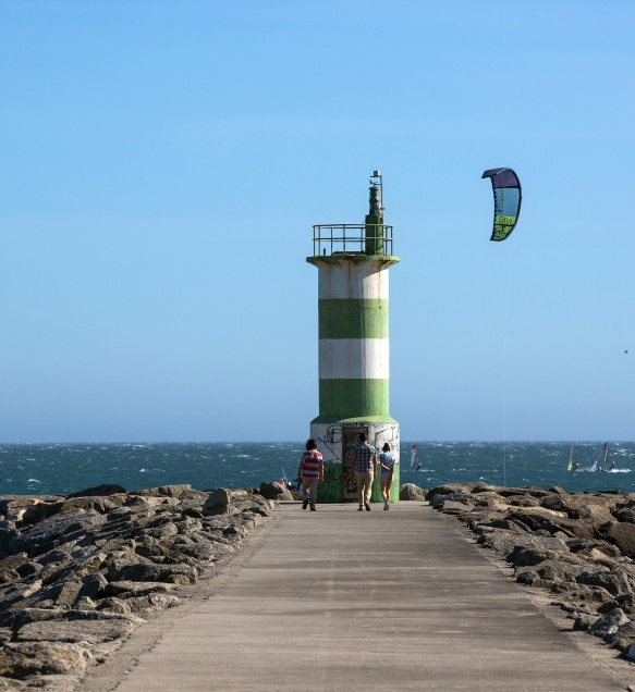
Viana do Castelo: from the Neiva River to Afife
Distance: 28 km (17.4 miles)
Estimated walking time: 8 hours 40 minutes
Type of route: Cultural and religious
Difficulty: Moderate
Pilgrims enter the municipality after crossing the Neiva River via Sebastião Bridge, in Castelo do Neiva. The route passes through Moldes, with the option of climbing up to the Church of Santiago de Castelo do Neiva, one of the most important sites associated with St. James along the entire route.
The Way continues through Santiago de Perlinha and São Romão do Neiva, passing close to the monastery. It then follows ancient paths through Chafé and Vila Nova de Anha, where pilgrims encounter traditional roadside shrines and Stations of the Cross.
After passing Monte de Faro, the route descends towards Darque and crosses the Lima River via the Eiffel Bridge. In the historic centre of Viana do Castelo, it passes the Cathedral, the Old Hospital (Hospital Velho), Praça da República, the Recolhimento de Santiago and the Chapel of São Roque.
Heading north, the Way leaves the city through Areosa. It continues past Quinta da Boa Viagem, crosses Carreço and follows forest trails towards Afife, passing the Monastery of São João de Cabanas before ending near the ancient fortified settlement of Cividade de Afife.
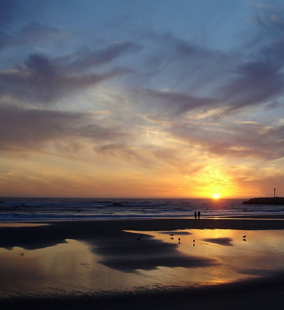
Caminha: from Âncora to the banks of the Minho River
Distance: 27 km (16.8 miles)
Estimated walking time: 6 hours
Type of route: Scenic, cultural and religious
Difficulty: Moderate
The Portuguese Coastal Way enters the municipality through the parish of Âncora, following forest trails and crossing the historic Ponte da Torre over the Âncora River.
In Vila Praia de Âncora, the route passes the Anta da Barrosa dolmen, Praça da República, the Chapel of Nossa Senhora da Bonança and Lagarteira Fort. It then continues along the coast, passing the Chapel of Santo Isidoro and the scenic landscapes of Moledo, with views of Ínsua Fort.
The old Camarido road leads through the Camarido National Forest and into the historic centre of Caminha. After passing the Clock Tower, the Misericórdia Church and the Main Church, the route crosses the Coura River.
The Way continues through Seixas and past the Chapel of São Bento, following the banks of the Minho River at various points. The final stretch through the municipality passes through Lanhelas, near Góios Hill.

Vila Nova de Cerveira: from Gondarém to Campos
Distance: 14.6 km (9.1 miles)
Estimated walking time: 4 hours
Type of route: Rural
Difficulty: Easy
The Portuguese Coastal Way enters the municipality through the rural areas of Gondarém, following paths along the slopes of Góios Hill and the Gávea mountain range. Passing manor houses, country estates, chapels and churches, the route continues towards Loivo and the historic centre of Vila Nova de Cerveira.
In the town, Vila Nova de Cerveira Castle and the medieval quarter are the main landmarks. From here, pilgrims can cross into Spain via the Friendship Bridge (Ponte da Amizade), towards Goián, or continue through Portugal to Valença.
Those heading towards Valença pass through Lovelhe, near the fort, before continuing through Reboreda and Campos, remaining relatively close to the banks of the Minho River.
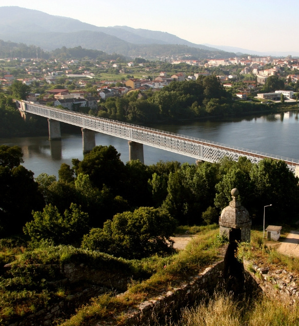
Valença: from the historic bridges to the Galician border
Distance: 16 km (9.9 miles)
Estimated walking time: 4 hours
Type of route: Rural and urban
Difficulty: Moderate
The final Portuguese section of the Coastal Way approaches Valença through the rural landscapes along the banks of the Minho River. The route passes Chamosinhos Bridge, associated with the ancient Roman road known as Per Loca Maritima, and the Veiga da Mira wetland habitat.
After crossing the medieval Veiga da Mira Bridge, pilgrims approach the fishing quay at Cristelo Covo before entering the town of Valença.
The Way enters Valença Fortress through the Coroada Gates, passing churches, bastions and historic military buildings before reaching the old iron bridge over the Minho River. Halfway across the bridge, pilgrims leave Portugal and enter Tui, in Galicia.
Valença is also where the Portuguese Coastal Way converges with the Central Portuguese Way.
How to continue from Valença to Santiago de Compostela?
After crossing the International Bridge, pilgrims enter Tui and continue along the Portuguese Way. The route generally passes through:
- Tui
- O Porriño
- Redondela
- Pontevedra
- Caldas de Reis
- Padrón
- Santiago de Compostela
The Galician coastal route, which enters through A Guarda, passes through Oia, Baiona and Vigo before joining the inland route at Redondela. From here, pilgrims follow the same route to Santiago de Compostela.
Can you cross the Minho River at Caminha?
Yes. The river crossing between Caminha and A Guarda allows pilgrims to continue along the Portuguese Coastal Way in Galicia, following the Atlantic coastline.
After A Guarda, the route continues through Oia, Baiona and Vigo, joining the Portuguese Way at Redondela. The first Galician stage, between A Guarda and Oia, runs mostly alongside the ocean, following a relatively flat, exposed route with little shade.
The availability of river crossings may depend on the tides and navigation conditions. Before setting off, it is important to check the timetables and confirm that the service is operating.
Where to stay along the Portuguese Coastal Way?
Along the route, pilgrims can choose from a wide range of accommodation options, including pilgrim hostels, youth hostels, hotels, guesthouses, rural retreats and other places to stay mentioned above.
Pilgrim hostels may have different rules regarding reservations, check-in times, the presentation of a Pilgrim's Credential and maximum length of stay. Always check the conditions directly with your chosen accommodation before travelling.
Here are some additional accommodation options for those looking for different types of experiences:
How to prepare for the Portuguese Coastal Way?
Train before setting off
Start with short walks and gradually increase the distance. Whenever possible, train with the backpack and footwear you intend to use on the Way.
The most important thing is not being able to complete a single long walk, but preparing your body to cover several kilometres on consecutive days.
Choose well-worn footwear
Do not wear brand-new hiking boots or walking shoes on your first day. The route combines asphalt, cobblestones, sand, wooden boardwalks, dirt tracks and uneven terrain. Your footwear should provide comfort, grip and stability while allowing your feet to breathe.
Keep your backpack light
Pack only the essentials. An overly heavy backpack increases fatigue and the risk of muscle pain, blisters and injuries. Take breaks before reaching exhaustion, stay well hydrated and stretch before and after each stage.
Protect yourself from the sun and wind
Much of the coastal route offers little shade. Even when temperatures seem mild, prolonged exposure to the sun and wind can cause dehydration and sunburn. Bring sunscreen, a hat, sunglasses and enough water to last between places where you can refill your bottle.
Book your accommodation in advance
During spring, summer, weekends and public holidays, some accommodation options may be fully booked. Check whether your chosen pilgrim hostel accepts reservations and confirm the latest permitted check-in time.
Useful information about the Portuguese Coastal Way
Where does the Portuguese Coastal Way start?
The most popular starting point is Porto Cathedral. From here, pilgrims can follow the historic route or head down towards Ribeira to walk along the Senda Litoral (Litoral Way).
How is the Way signposted?
The Way is marked with yellow arrows, scallop shells and other traditional symbols associated with the pilgrimage to Santiago de Compostela.
In the Portuguese Coastal Way's distinctive visual identity, the waves represent its connection to the sea, while the ten circles surrounding the scallop shell symbolise the ten municipalities crossed by the route. Even though the Way is signposted, downloading an offline map is recommended.
What is the Pilgrim's Credential?
The Pilgrim's Credential is the official document in which pilgrims collect stamps to confirm their passage through different locations along the Way. It can be stamped at pilgrim hostels, churches, tourist information offices, parish council offices, accommodation establishments and other participating locations.
The credential is also required to stay at many hostels specifically intended for pilgrims.
What are the requirements for obtaining the Compostela?
To qualify for the Compostela, pilgrims must complete at least 100 continuous kilometres (62 miles) on foot or horseback, or 200 kilometres (124 miles) by bicycle, along a recognised pilgrimage route ending in Santiago de Compostela.
When the pilgrimage begins outside Spain, as is the case with the Portuguese Coastal Way starting in Porto, at least 70 continuous kilometres (43.5 miles) must be completed on Spanish territory.
Pilgrims must also collect at least two stamps per day in their Pilgrim's Credential over the final 100 kilometres when travelling on foot or horseback, or the final 200 kilometres when cycling.
When is the best time to walk the Portuguese Coastal Way?
Spring and early autumn generally offer milder temperatures and sufficiently long daylight hours. Summer provides more hours of daylight, but also brings greater sun exposure and higher demand for accommodation. In winter, rain, wind, slippery surfaces and shorter days can make the stages more challenging.
Whatever the season, always check the weather forecast before setting off each day.
Can you cycle the Portuguese Coastal Way?
Yes. However, some wooden boardwalks, narrow paths, cobbled sections and uneven surfaces may require cyclists to dismount or find a suitable alternative route.
Preparation should take into account the type of bicycle, luggage transport, road safety and any restrictions applying to pedestrian boardwalks.
Is public transport available along the route?
Yes. Several towns and villages along the Portuguese Coastal Way are served by rail or bus connections.
There are various rail and bus services along the route. The Minho railway line serves destinations such as Porto, Viana do Castelo, Caminha, Vila Nova de Cerveira and Valença, while Vila do Conde and Póvoa de Varzim are connected by the Porto Metro. These transport options can be useful for taking a break from the pilgrimage, returning to your starting point or adjusting the length of a stage.
Timetables and conditions for transporting bicycles should be checked before travelling.
Did you know?
The Portuguese Coastal Way was officially certified in 2022, and its certification was renewed in 2025.
The Portuguese Coastal Way was officially certified under Ordinance No. 67/2022 of 2 February. In 2025, its certification was renewed by the Way of St. James Certification Committee, following an assessment of the route’s management and conditions.